Geography Matter!

Sunday, February 14, 2010

Groundwater Erosion


Groundwater erosion is running water on the surface of the earth erodes the land. Groundwater also can cause erosion under the surface. As water flows through the soil, acid is formed. This acid can cause minerals to be dissolved. Minerals that are carried in groundwater can also be deposited in other places. This cycle of erosion and deposition can cause underground caves to form.

This happens especially in areas where there is limestones below the surface. A cave is an underground opening. It has a connection to the surface of the earth. A cave is formed by the erosion of limestone under the ground. The acid water moves through the cracks in the limestone and makes them larger.

~Kimberley Lim~

River Deposition


There are 4 stages in river deposition. 1. levees and meanders. 2. deltas. 3. floodplains. 4. oxbows. River deposition is the opposite of erosion. It is where a river lays down or drops the sediment or material that it is carrying. Rivers carry lots of different sediment, including rocks, boulders, silt, mud, pebbles and stones. Normally, a river has the power to carry sediment. If the force of a river drops, the river cannot carry sediments. This is when the river deposits its sediments.

Types of deposition: (There can be much evidence of deposition in a river)
1. Areas of pebbles and stones
2. Areas where mud and sand and silt have been deposited.
3. Large boulders and stones in the middles of a river
4. Tree branches and trees in a river
5. Pollution like cans, bottles, crisp wrappers & other rubbish.

~Kimberley Lim~

Meanders


Meanders in general, is a bend in a sinuous water course. It is formed when the moving water in a river erodes the outer banks and widens its valley. A stream of any volume may assume a meandering course, alternatively eroding sediments from the outside of a bend and depositing then on the inside. The result, a snaking pattern as the stream meanders back and forth across its down-valley axis.

When a meander gets cut off from the main stream, an oxbow lake is formed. Over time, meanders migrate downstream, sometimes in a short period of time as to create civil engineering problems for local municipalities attempting to maintain stable roads and bridges.

~Kimberley Lim~

Saturday, February 13, 2010

Delta

A delta is a landform that is created at the mouth of a river where that river flows into an ocean, sea, estuary, lake, reservoir, flat arid area, or another river. Deltas are formed from the deposition of the sediment carried by the river as the flow leaves the mouth of the river. Over long periods of time, this deposition builds the characteristic geographic pattern of a river delta.

-------------------------------------------------------------------------------------------------------------
River deltas form when a river carrying sediment reaches a body of standing water, such as a lake, ocean, or reservoir. When the flow enters the standing water, it is no longer confined to its channel and expands in width. This flow expansion results in a decrease in the flow velocity, which diminishes the ability of the flow to transport sediment. As a result, sediment drops out of the flow and deposits. Over time, this single channel will build a deltaic lobe (such as the bird's-foot of the Mississippi or Ural River deltas), pushing its mouth further into the standing water. As the deltaic lobe advances, the gradient of the river channel becomes lower because the river channel is longer but has the same change in elevation (see slope). As the slope of the river channel decreases, it becomes unstable for two reasons. First, water under the force of gravity will tend to flow in the most direct course down slope. If the river could breach its natural levees (i.e., during a flood), it would spill out onto a new course with a shorter route to the ocean, thereby obtaining a more stable steeper slope.[1] Second, as its slope gets lower, the amount of shear stress on the bed will decrease, which will result in deposition of sediment within the channel and for the channel bed to rise relative to the floodplain. This will make it easier for the river to breach its levees and cut a new channel that enters the body of standing water at a steeper slope. Often when the channel does this, some of its flow can remain in the abandoned channel. When these channel switching events happen repeatedly over time, a mature delta will gain a distributary network.


Another way in which these distributary networks may form is from the deposition of mouth bars (mid-channel sand and/or gravel bars at the mouth of a river). When this mid-channel bar is deposited at the mouth of a river, the flow is routed around it. This results in additional deposition on the upstream end of the mouth-bar, which splits the river into two distributary channels. A good example of the result of this process is the Wax Lake Delta in Louisiana.


In both of these cases, depositional processes force redistribution of deposition from areas of high deposition to areas of low deposition. This results in the smoothing of the planform (or map-view) shape of the delta as the channels move across its surface and deposit sediment. Because the sediment is laid down in this fashion, the shape of these deltas approximates a fan. It is closer to an ideal fan the more often the flow changes course because more rapid changes in channel position results in more uniform deposition of sediment on the delta front. The Mississippi and Ural River deltas, with their bird's-feet, are examples of rivers that do not avulse often enough to form a symmetrical fan shape. Alluvial fan deltas, as seen in their name, avulse frequently and more closely approximate an ideal fan shape.

-Jiayu-

Estuary

Estuary of Klamath RiverAn estuary is a partly enclosed coastal body of water with one or more rivers or streams flowing into it, and with a free connection to the open sea


Estuaries form a transition zone between river environments and ocean environments and are subject to both marine influences, such as tides, waves, and the influx of saline water; and riverine influences, such as flows of fresh water and sediment. The inflow of both seawater and freshwater provide high levels of nutrients in both the water column and sediment, making estuaries among the most productive natural habitats in the world


Most modern-day estuaries were formed during the Holocene epoch by the flooding of river-eroded or glacially-scoured valleys when sea level began to rise about 10,000-12,000 years ago Estuaries are typically classified by their geomorphological features or by water circulation patterns and can be referred to by many different names, such as bays, harbors, lagoons, inlets, or sounds, although sometimes these water bodies do not necessarily meet the above criteria of an estuary and may be fully saline.


Estuaries are amongst the most heavily populated areas throughout the world, with about 60% of the world’s population living along estuaries and the coast. As a result, estuaries are suffering degradation by many factors, including sedimentation from soil erosion from deforestation; overgrazing and other poor farming practices; overfishing; drainage and filling of wetlands; eutrophication due to excessive nutrients from sewage and animal wastes; pollutants including heavy metals, PCBs, radionuclides and hydrocarbons from sewage inputs; and diking or damming for flood control or water diversion

Waterfall

Typically, a river flows over a large step in the rocks that may have been formed by a fault line. As it increases its velocity at the edge of the waterfall, it plucks material from the riverbed. This causes the waterfall to carve deeper into the bed and to recede upstream. Often over time, the waterfall will recede back to form a canyon or gorge downstream as it recedes upstream, and it will carve deeper into the ridge above it.


Often, the rock stratum just below the more resistant shelf will be of a softer type, meaning that undercutting due to splashback will occur here to form a shallow cave-like formation known as a rock shelter or plunge pool under and behind the waterfall. Eventually, the outcropping, more resistant cap rock will collapse under pressure to add blocks of rock to the base of the waterfall. These blocks of rock are then broken down into smaller boulders by attrition as they collide with each other, and they also erode the base of the waterfall by abrasion, creating a deep plunge pool or gorge.


Streams become wider and shallower just above waterfalls due to flowing over the rock shelf, and there is usually a deep pool just below the waterfall because of the kinetic energy of the water hitting the bottom. Waterfalls normally form in a rocky area due to erosion. After a long period of being fully formed, the water falling off the ledge will retreat, causing a horizontal pit parallel to the waterfall wall. Eventually, as the pit grows deeper, the waterfall collapses.


Waterfalls can occur along the edge of a glacial trough, whereby a stream or river flowing into a glacier continues to flow into a valley after the glacier has receded or melted. The large waterfalls in Yosemite Valley are examples of this phenomenon. The rivers are flowing from hanging valleys.

-Jiayu-

River Valley

The terms U-shaped and V-shaped are descriptive terms of geography to characterize the form of valleys. Most valleys belong to one of these two main types or a mixture of them, at least with respect of the cross section of the slopes or hillsides.

A valley formed by flowing water, or river valley, is usually V-shaped. The exact shape will depend on the characteristics of the stream flowing through it. Rivers with steep gradients, as in mountain ranges, produce steep walls and a narrow bottom. Shallower slopes may produce broader and gentler valleys, but in the lowest stretch of a river, where it approaches its base level, it begins to deposit sediment and the valley bottom becomes a floodplain.


Some broad V examples are:


USA: Black Canyon of the Gunnison National Park, and others in Grand Canyon NP

Alpine Europe:

Austria: narrow passages of upper Inn valley (Inntal), affluents of Enns a.s.o

Switzerland: Napf region, Zurich Oberland, Engadin

Germany: affluents to the middle reaches of Rhine and Mosel

-Jiayu-

Saturday, February 6, 2010

Rapids


Rapids

Usually, rapids is part of a river where the current runs very swiftly.Its is also a section of a river where the river bed has a relatively steep gradient causing an increase in water turbulence and water velocity. A rapid is also characterised by the river becoming shallower and having some rocks exposed above the flow surface.Rapids occur where the bed material is highly resistant to the erosive power of the stream in comparison with the bed downstream of the rapids.Very young streams flowing across solid rock may be rapids.


Rapids form in a similar way to waterfalls. The river bed drops down steeply, but not as a cliff, otherwise a waterfall would form. Rapids can often be found above waterfalls where the river bed is starting to drop. Rapids form a layer of hard rock on the river bed. Rapids are found in the upper course of the river.
-Samantha lye

Oxbow lakes


Oxbow lakes


An oxbow lake is a U-shaped body of water formed when a wide meander from the main stem of a river is cut off to create a lake. This landform is called an oxbow lake for the distinctive curved shape that results from this process.An oxbow lake will slowly be created as soil erodes and re-deposits, changing the river's original course.
On the inside of the loop, the river travels more slowly leading to deposition of silt, while water on the outside edges tends to flow faster, eroding the outside banks.

Over time the loop of the meander widens until the neck vanishes altogether.

Eventually the bend becomes isolated from the river's path and a horseshoe shaped oxbow lake is formed.

Once the water stops flowing in the former river bed, sediment begins to build up in the lake. Eventually the lake will become a wetland, then a meadow, then trees will take root. In a process known as "succession," what was once river will one day become a forest.
Source:wikipedia,http://www.nywetlands.com/oxbowlake.html
-Samantha lye

Friday, February 5, 2010

Alluvial fans/canyons


Alluvial fans:


An alluvial fan is a fan-shaped deposit formed where a fast flowing stream flattens, slows, and spreads typically at the exit of a canyon onto a flatter plain. A convergence of neighboring alluvial fans into a single apron of deposits against a slope is called a bajada, or compound alluvial fan.


Alluvial fans are formed when slowing streams and stream branches deposits sediments along the edge of the current. They grow in width as the streams and branches meander. Slowing streams meander because they also deposit sediments in their channels, raising the level of the water, causing sediments at the stream edges to collapse.This frequently occurs at the mouths of narrower canyon,because streams slow where their channels widen and slopes become gentler.


Alluvial fans are subject to flooding and can be even more dangerous than the upstream canyons that feed them. Their slightly convex perpendicular surfaces cause water to spread widely until there is no zone of refuge. If the gradient is steep, active transport of materials down the fan creates a moving substrate that is inhospitable to travel on foot or wheels. But as the gradient diminishes downslope, water comes down from above faster than it can flow away downstream, and may pond to hazardous depths.
In the case of the Koshi River, the huge sediment load and megafan's slightly convex transverse surface conspire against engineering efforts to contain peak flows inside manmade embankments. In August 2008 high monsoon flows breached the embankment, diverting most of the river into an unprotected ancient channel and across surrounding lands with high population density. Over a million people were rendered homeless, about a thousand lost their lives and thousands of hectares of crops were destroyed.


Souce:Wikipedia,yahoo,google images


Canyon:


A canyon means a ravine formed by a river with little rainfall.Canyons are formed by erosion caused by rivers. Cliffs on either side of a canyon are made of harder rock, but the area that has been worn away tends to be of a softer rock which is easily weathered by water, and also by wind. A canyon may also refer to a rift between two mountain peaks such as those in ranges such as the Rocky Mountains, the Alps, the Himalayas or the Andes. Usually a river or stream and erosion carve out such splits between mountains. Examples of mountain type canyons are Provo Canyon in Utah or Yosemite National Park in California's Sierra Nevada. Canyons within mountains or gorges that only have an opening on one side are called box canyons. Slot canyons are very narrow canyons, often with smooth walls.


Canyons are good for buliding dams to generate hydro-electric power.Examples of this is the hoover dam.

-samantha lye

Rivers:

Why(do rivers exist?):Rivers provide us with food, energy, recreation, transportation routes, and of course water for irrigation and for drinking.

How(do rivers form?):Rivers begin in mountains or hills, where rain water or snowmelt collects and forms tiny streams called gullies. Gullies either grow larger when they collect more water and become streams themselves or meet streams and add to the water already in the stream. When one stream meets another and they merge together, the smaller stream is known as a tributary. The two streams meet at a confluence. It takes many tributary streams to form a river. A river grows larger as it collects water from more tributaries. Streams usually form rivers in the higher elevations of mountains and hills.

Impacts(on people):
Negative>Flooding,Irregular dry season water level fluctuations,Large amounts of riverbank erosion,Changing discharge – high & low flows,Changing river channels.

Positive>Source of food,water,transportation.(Some people enjoy the peace and tranquility flowing water can offer.)

Sources:http://geography.about.com/od/physicalgeography/a/rivers.htm
http://www.mekonginfo.org/mrc_en/doclib.nsf/a3f3e063e09301c3472571a00021e2f0/a651f1a4a904cbb085256fb10011ff04?OpenDocument
http://www.ralphallen.org/New%20school%20web%20site/subject%20areas/Geography%20resources/12Geography_files/Rivers/WORD%20documents/RIVERS%2010.doc
http://www.sln.org.uk/geography/enquiry/we30.htm

~Nicole Mui~
River VS Waterfall

River:
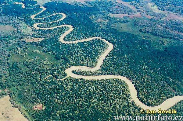
About:A part of river where current is very fast
Formation:Forms due to increase in water flow characterized by a river becoming shallower.
Created by:Four factors, separately or in combination, can create rapids: gradient, constriction, obstruction, and flow rate.
Examples:Violent water below Niagara Falls, Des Moines Rapids, etc.
Artificially:Generally not created artifically
Types:6

1Has small waves in fast moving water and very few obstacles.
2Has wide channels and rapids that are easy to navigate, without many turns or obstacles. Small waves less than two feet high.
3Intermediate. Strong currents require training and ability to maneuver quickly and effectively. From this class on, rafters require a guide. Not suitable for young children.
4Advanced. Powerful rapids for strong paddlers that can handle fierce turns and spins. Drops and waves are common.
5Expert. Violent, dangerous rapids, usually formed through obstructed channels, tight turns, and soaring falls.
6Unrunnable. Likelihood of death in attempting class 6 runs.(TYPES)


Waterfall:
About:A permanent flow of water over the edge of an erosion-resistant cliff.
Formation:Forms due to sudden break in elevation or nickpoint of a rock due to water flowing over it.
Created by:Creation of a steep, vertical drop and a plunge pool into which the water of river falls.
Examples:Angel Falls, Boyoma Falls, Victoria Falls, etc.
Artificially:Created artificially in miniature form as part of garden decoration etc.
Types:10

1Block: Water descends from a relatively wide stream or river.
2Cascade: Water descends a series of rock steps.
3Cataract: A large waterfall.
4Fan: Water spreads horizontally as it descends while remaining in contact with bedrock.
5Horsetail: Descending water maintains some contact with bedrock.
6Plunge: Water descends vertically, losing contact with the bedrock surface.
7Punchbowl: Water descends in a constricted form, then spreads out in a wider pool.
8Segmented: Distinctly separate flows of water form as it descends.
9Tiered: Water drops in a series of distinct steps or falls.
10Multistep: A series of waterfalls one after another of roughly the same size each with its own sunken plunge pool.

Source:http://www.diffen.com/difference/Rapid_vs_Waterfall

~Nicole Mui~
Swamps>are formed in soft, low lying ground near to a source of ample water. That source may be the ocean, a lake, a river, or even anaquifer. They tend to be small and compact. Swamps are of each extremein the time that they exist: a swamp with a good water source and little disturbance can exist longer than a mountain range.

Potholes>Upper course
Floodplains>Middle course
Levees>Lower course
River Terraces>Lower course
Swamps>Lower course
(I forgot to mention in my previos post)

Source:http://www.fantasymaps.com/101/swamp.html

~Nicole Mui~
Some features found along the course of a river are:Potholes,Floodplains,Leeves and swamps.

How are these features formed:

Potholes>are formed by corrasion. Pebbles carried by the river are swirled around on the river bed. This action erodes the rock on the river bed forming potholes. Over time, they may widen and join with other potholes to form larger potholes, and the whole river bed is deepened.

Floodplains>are formed in two ways: by erosion; and by aggradation.
An erosional floodplain is created as a stream cuts deeper into its channel and laterally into its banks.
A stream with a steep gradient(meaning:the degree of inclination,or the rate of ascent or descent,in a highway,railroad,etc.) will tend to downcut faster than it causes lateral erosion, resulting in a deep, narrow channel with little or no floodplain at all.

Levees>can be natural or man-made. A natural levee is formed when sediment settles on the river bank, raising the level of the land around the river.


River terraces>part of an old flood plain that has been left perched on the side of a river valley. It results from rejuvenation, a renewal in the erosive powers of a river. River terraces may be fertile and are often used for farming. They are also commonly chosen as sites for human settlement because they are safe from flooding.

Sources:http://library.thinkquest.org/28022/trail/pothole.html
http://www.sciencedaily.com/articles/f/floodplain.htm
http://architecture.about.com/od/damsresevoirs/g/levee.htm
http://www.talktalk.co.uk/reference/encyclopaedia/hutchinson/m0035442.html

~Nicole Mui~